


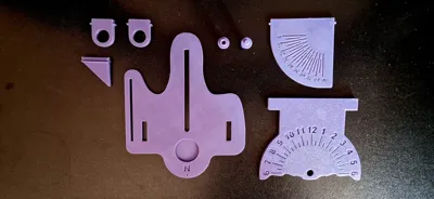
Print Profile(2)


Description
Boost Me (for free)
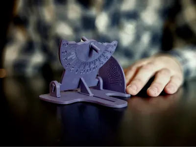
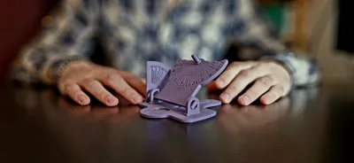
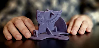
Equatorial Sundial – Solar Clock & Compass
This equatorial sundial is a precise and adjustable solar clock, designed to be easily 3D printed and used at different latitudes.
How Does It Work?
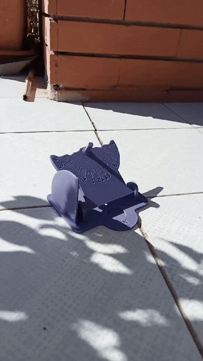
The sundial uses a gnomon inclined parallel to the Earth's axis, which casts a shadow on the equatorial plane. To align it to the equatorial plane, simply tilt it to the latitude where you are positioned. To align the gnomon to the Earth axis point it north.

Since it aligns with the Earth's axis, the hour lines are equidistant, allowing an accurate reading of true solar time.
The Sundial Plane have two faces. The esternal face (Face A) is used in spring and summer and the internal face (Face B) is used in winter and fall.

Solar Compass Function – Find True North
In addition to measuring solar time, this sundial can be used as a solar compass to determine True North.
How to use it?
- Place the sundial on a flat surface.
- Rotate it until it correctly indicates the known solar time.
- Once aligned, the front of the sundial will point to True North!
What if I want to use a magnetic compass?
- If you wish to integrate a mini magnetic compass into the base, remember that it points to the Magnetic North, which differs from True North.
- The difference between Magnetic and True North depends on your latitude and longitude and is called magnetic declination.
- You can correct this difference by checking a local magnetic declination map and adjusting the orientation accordingly.
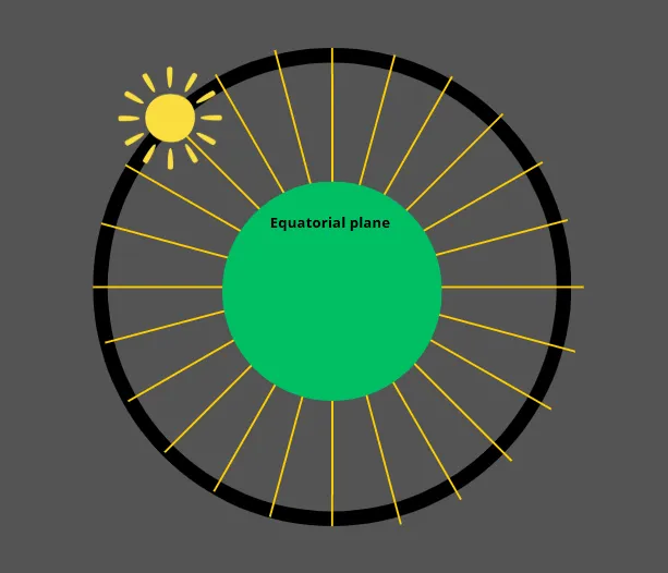
Seasonal Variation
This sundial is highly accurate, except for the variation in the angle of the Sun’s rays relative to the equatorial plane due to seasonal changes.

This effect, caused by the tilt of the Earth's axis, makes the shadow appear slightly higher or lower depending on the time of year. Here a chart showing how and when is the variation.

This explanation is valid for both hemispheres, however the southern hemisphere version of the sundial should be pointed south, and the two faces works in reverse
License
You shall not share, sub-license, sell, rent, host, transfer, or distribute in any way the digital or 3D printed versions of this object, nor any other derivative work of this object in its digital or physical format (including - but not limited to - remixes of this object, and hosting on other digital platforms). The objects may not be used without permission in any way whatsoever in which you charge money, or collect fees.
Comment & Rating (15)