Map of the Netherlands – Learn Provinces&Capitals


Print Profile(1)

Description
English:
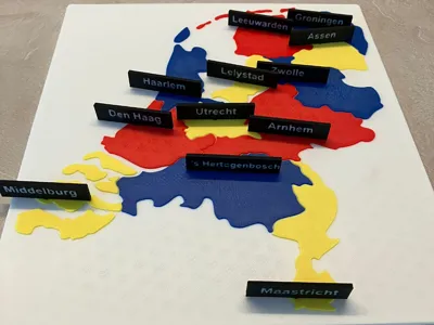
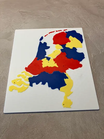
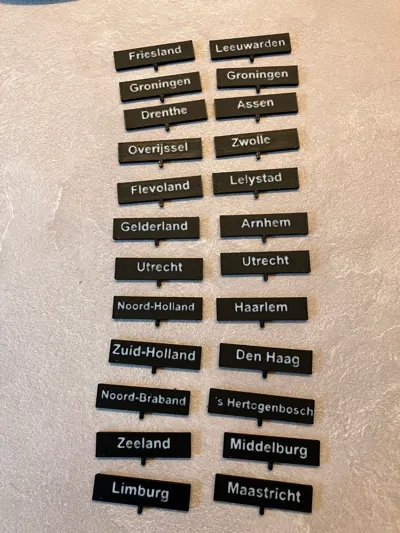
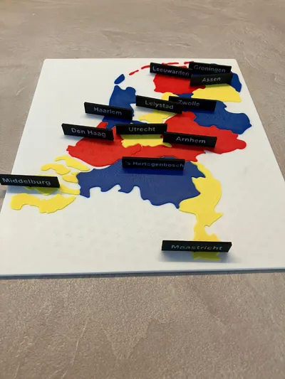
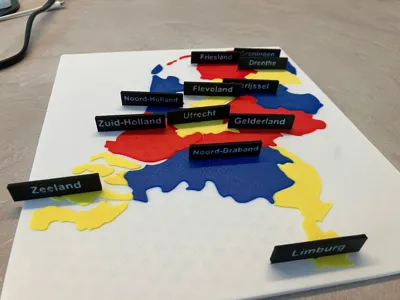
Make learning geography fun with this 3D printable map of the Netherlands! The map features clearly defined provinces and slots for inserting cards with the names of provinces or their capitals. Designed for 4-color AMS printers, but also compatible with standard 3D printers. Without AMS, you can simply pause the print at layer 15 to switch colors manually. Perfect as an educational tool for home or classroom use, or as an engaging learning game. Easy to print and customize with your favorite colors. A fantastic way to teach children about the geography of the Netherlands in a playful and hands-on manner!
Dutch:
Maak topografie leren leuk met deze 3D-printbare kaart van Nederland! De kaart toont alle provincies duidelijk afgebakend en bevat vakken waar kaartjes met de namen van provincies of hoofdsteden in kunnen worden gestoken. Ontworpen voor 4-kleuren AMS-printers, maar ook geschikt voor standaard 3D-printers. Zonder AMS kun je de print pauzeren op laag 15 om eenvoudig van kleur te wisselen. Perfect als educatief hulpmiddel voor thuis of in de klas, of als leerzaam spel. Gemakkelijk te printen en te personaliseren met je favoriete kleuren. Een ideale manier om kinderen op een speelse manier kennis te laten maken met de topografie van Nederland!
I've used the keychain maker tool to create the map: https://makerworld.com/en/makerlab/imageToKeychain
Comment & Rating (3)